
Walk a Cloverleaf Street
A street-by-street search in Cloverleaf begins with a parcel, not a roster of names. Cloverleaf is an unincorporated Harris County census-designated place, so the useful current records are held by county offices. Harris County Appraisal District, usually called HCAD, provides the public appraisal record. It can anchor an address to an account number, a property or situs address, an owner display, a mailing address, a legal description, and a map link. That is a strong beginning, but it is not proof that every person connected with an address lives there.
For a Cloverleaf street directory search, keep the physical address and the owner mailing address in separate notes. Then move from the HCAD result to the parcel map and the County Clerk’s recorded-instrument index. The parcel and legal-description fields narrow a common surname far better than a broad name search. Historical street pages can add dated occupant evidence after the current parcel trail is clear.
- Search the street number and name in HCAD. Save the account number, situs address, owner display, subdivision, and lot or block if shown.
- Open the parcel in the HCAD viewer. Browse the street segment, confirm the parcel polygon, and note only the neighboring parcel identifiers needed for the record trail.
- Use the legal description and current owner as separate keys in the Harris County Clerk real-property index. Read the recorded image before deciding that an indexed party transferred the target parcel.
- For a lawful registration check, use the Texas voter process for an individual or the controlled voter-file request route. It is not a street-wide household list.
- For a dated address-to-occupant lead, inspect a historical street or criss-cross directory page and record its publication year and page number.
That sequence makes the Cloverleaf street directory useful for a public-records trail without treating one field as a complete answer.
Cloverleaf Street Directory Fields
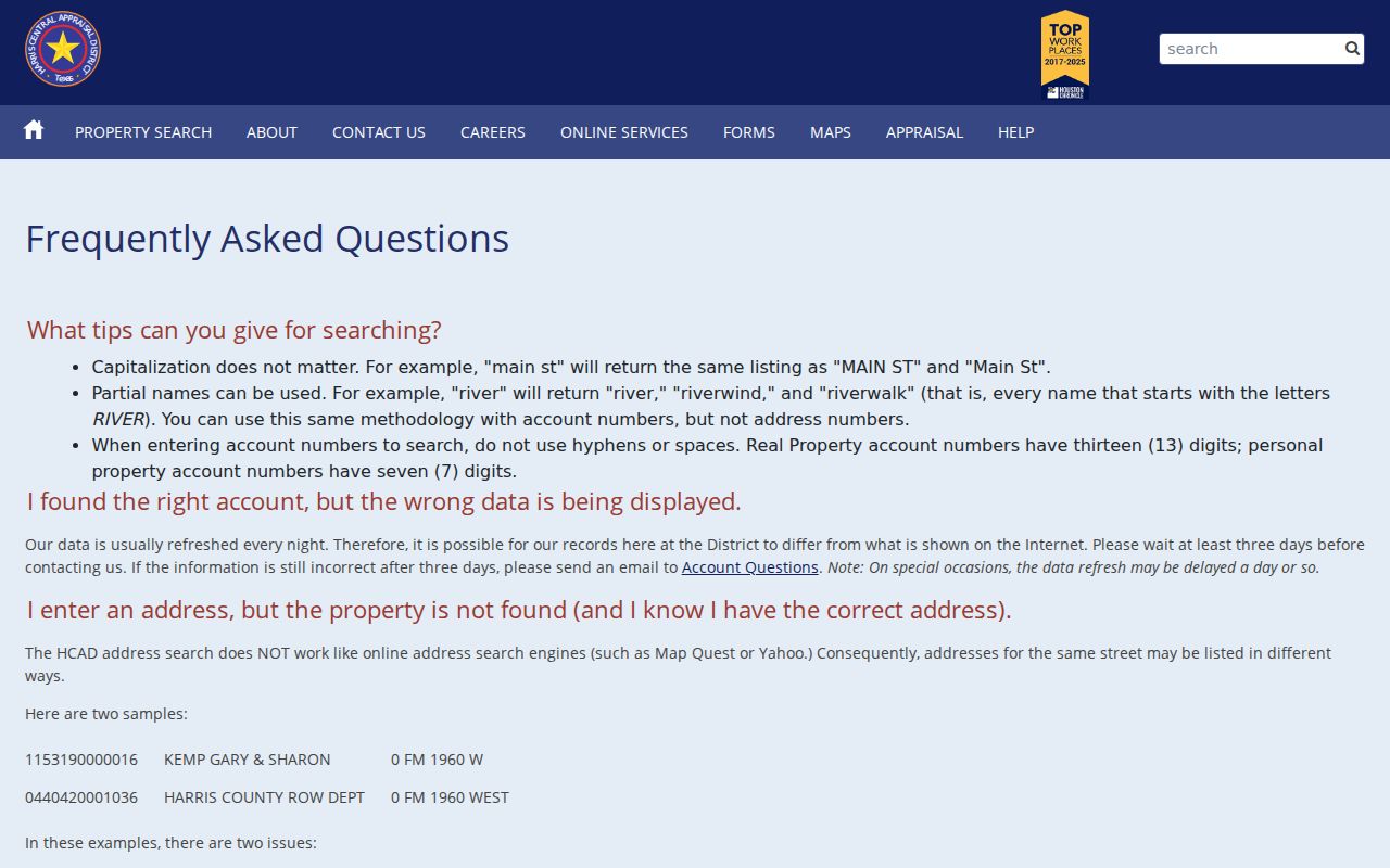
HCAD is the main current parcel entry point for a Cloverleaf address. Its address search is not a map-app search. Street names can be stored in more than one form, and an unknown or vacant address may use a zero address. Run an address search, a street-name search, and a numbered range when one method misses a parcel. HCAD refreshes appraisal data normally each night, and a discrepancy may take about three days to settle before it should be treated as an error.
| HCAD field | Input | Required | Street-directory use |
|---|---|---|---|
| Account number | Text, normally 13 digits | No | The most precise public parcel key when known. |
| Owner name | Prefix or partial text | No | Test surname, initials, punctuation, or entity variants. |
| Property or situs address | Address components | No | Find one property and test alternate street forms. |
| Property Street Name | Advanced text field | No | Browse a named Cloverleaf street. |
| Beginning and Ending numbers | Number pair | No | Limit a search to a street segment. |
| Values on Same Street | Details-page link | Conditional | Open nearby account and value context without calling it a household list. |
The HCAD address-search help shows the advanced address and range approach used for this type of Cloverleaf street directory work.
See the official HCAD address-search instructions before choosing a street range or an alternate address form.
Cloverleaf Parcel Viewer Routes
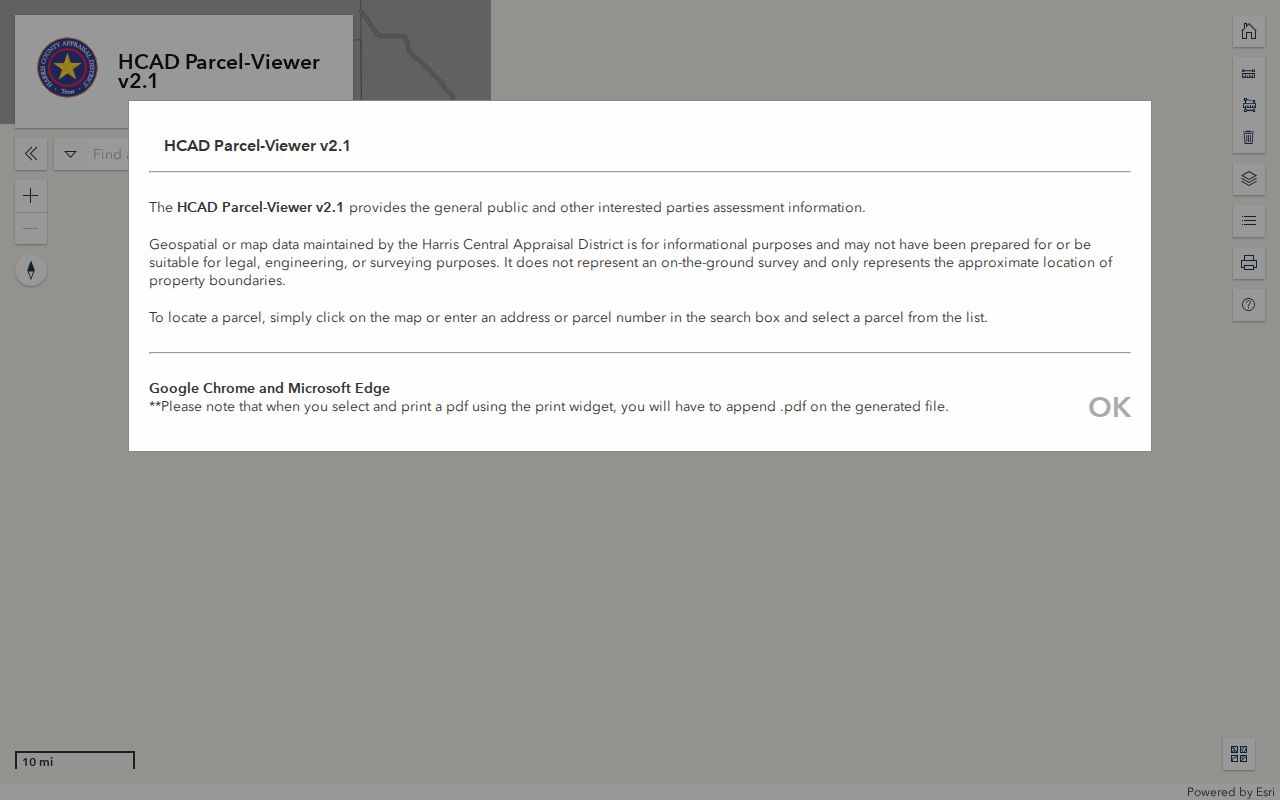
The HCAD Parcel Viewer v2.1 adds the map context that the HCAD results list cannot show. Enter an address or parcel number, select the resulting polygon, then pan or zoom until parcel lines and street labels can be read. Clicking an adjacent polygon opens its associated parcel details. A basemap gallery, layers, measurement controls, and printing tools can help identify a short street segment.
The map is approximate and is not a survey. Missing geometry can mean that an account predates mapping, has an alternate address, uses a zero address, or needs correction. In that case, return to HCAD’s address or account search and compare the legal description with the County Clerk record. The viewer is most helpful for locating a public parcel record, not for deciding a property line or a person’s presence.
The official parcel viewer is the source for this Cloverleaf map-search interface.
Cloverleaf Situs and Mailing
HCAD separates the parcel’s situs address from the owner mailing address. The situs is the physical property location and is the better key for a street segment. The mailing address is where appraisal or tax notices go. It may be outside Cloverleaf, may be stale, and does not establish occupancy. This distinction is a common source of false matches when an address is copied without its field label.
- Parcel
- A discrete tract used in appraisal and mapping records. The HCAD account number identifies the appraisal record for that parcel.
- Situs address
- The physical property location used by HCAD and GIS. It can differ from a mailing label or a historical form of the address.
- Plat
- A recorded map that can show a subdivision’s lots, blocks, and layout. It can help reconcile a street address with the legal description.
- Criss-cross directory
- A historical directory arranged by street or address rather than alphabetically, useful for dated occupant or business entries.
HCAD’s homestead exemption is another field that needs care. It can be consistent with owner-occupied use, but it is not conclusive proof of residency. Eligibility, timing, application status, or a correction can explain an absent or present exemption.
Cloverleaf Street Records
Different address-keyed records answer different questions. The appraisal card is useful for the current parcel framework. The GIS viewer shows adjacency. The Clerk’s index documents recorded instruments. Tax statements show billing context, while historical directories connect an address to a dated printed entry. Joining them requires the account and legal description, not just a street name.
| Address record | Key | What it can show | Access route |
|---|---|---|---|
| HCAD parcel card | Account, address, or owner | Appraisal owner, situs and mailing fields, values, exemptions, and legal description | Public HCAD search; office or correction form for errors. |
| HCAD Parcel Viewer | Address or parcel ID | Parcel polygon, nearby parcels, district context, and record links | Public interactive viewer; approximate mapping. |
| Recorded deed index | Party or legal description | Transfers, liens, releases, restrictions, plats, and title sequence | Online index from January 1961; older books or microfilm. |
| Tax statement | Account, name, or address | Billing, receipts, tax units, and payment context | Public tax-statement search; it is not title evidence. |
| Directory street page | Street, page, and year | Historical occupants, phones, and printed residence notation | Library or digitized collection; inspect the page image. |
| Permit or code file | Address, legal description, and date | Work dates and applicant or owner fields when released | No verified Cloverleaf portal; request an existing file from the custodian. |
Note: A public tax statement or parcel-card name does not replace the recorded deed or establish who is physically present at an address.
Cloverleaf Deed Chain
The Harris County Clerk Real Property Search is the title-record step in a Cloverleaf street directory search. Start with the HCAD legal description, then search the present owner as grantee and use the subdivision, lot, block, abstract, or tract fields to narrow the result. Open the purchase deed image where available. The current owner is generally the grantee, and the seller is the grantor. Search that seller as an earlier grantee to move backward.
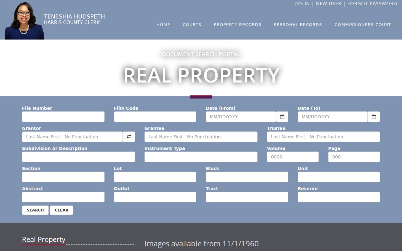
The portal also accepts file number, film code, date range, grantor, grantee, trustee, subdivision or description, instrument type, and volume or page fields. A file number or film code is more precise than a wide name search once it is known. Search grantor and grantee separately because a common name may produce unrelated instruments. A deed of trust, release, assignment, lien, probate transfer, or restriction amendment can explain a name change without being a sale deed.
The Harris County Clerk’s real-property search displays the fields used to move from a Cloverleaf parcel to recorded instruments.
Cloverleaf Legal Descriptions
When a street number fails, the subdivision, lot, block, unit, abstract, outlot, or tract can bridge the gap. These legal-description elements appear in HCAD, plats, deeds, and the Clerk index. They are especially useful when a record uses a different address form, a street spelling changes, or a historical source uses a nearby post-office heading. A legal description does not have to look like a street address to identify the same parcel.
Restrictions and plats can also be searched by subdivision. For post-1961 records, the Clerk index can be narrowed with instrument types such as RESTR and AMEND. Earlier restrictions may need microfilm. Surveys are not typically filed as routine records, but a subdivision or condominium plat may resolve a lot and block or show why a street label changed.
Use HCAD’s current or old address display, a plat, the Clerk’s legal description, USPS standardization, and historical street pages together when the chain breaks. No official Cloverleaf-specific street-renumbering or street-renaming year was located in the reviewed sources. That gap is a reason to preserve the alternate wording in research notes, not a reason to assign an unsupported bridge year.
Cloverleaf’s 1961 Index Divide
Harris County’s record history creates a real break in the modern street trail. The electronic real-property index begins in January 1961, while images are available from November 1, 1960. The Clerk reports book-form public records from 1836 through the late 1950s, and the 1955 to 1960 transition can require physical or microfilm research. A quiet online result for an older Cloverleaf address may therefore indicate the wrong access channel, not the absence of a record.
For the older end of a deed or plat chain, use the County Clerk’s books or microfilm, the historical warehouse at 11525 Todd Street, a Harris County Archives appointment, Texas State Library and Archives Commission reels, or selected FamilySearch images. The creating office and series matter. County records moved into digital access on different schedules, so an appraisal result, a Clerk index result, and an archive finding aid should not be expected to cover identical years.
Cloverleaf Street Directory History
For older occupants, the useful reverse layer is a historical criss-cross directory. Houston Public Library holds Houston directories from the nineteenth century through 1986, with digitized 1866 to 1924 runs and partial 1925 to 1959 coverage in HeritageQuest. The 1940 to 1941 Page-Interstate and Daily Sun modern directory for the eastern Harris corridor has street-by-street pages. Search a street heading, inspect the scan, and record the printed page and year rather than relying on OCR alone.
Historical publisher geography can be misleading. A Cloverleaf-area address may be filed under Houston, Channelview, Pelly, Baytown, Goose Creek, or another post-office heading. An entry can include a spouse in parentheses, an occupation, an employer, a phone, and h or r residence notation. It is dated directory evidence, not a current parcel ownership record. The collection details and directory-reading methods are available on the Cloverleaf city directory page.
Cloverleaf ZIP Labels
A mailing city or ZIP should not replace parcel geography in a Cloverleaf street directory search. WCID 36 describes its service area as the Cloverleaf area inside 77015, while 77530 and other adjacent ZIP labels appear near the CDP reference area. The postal label may say Houston even when the parcel is in unincorporated Harris County. A 77530 or Channelview label can be nearby without proving that an address lies inside Cloverleaf.
Use USPS address guidance for delivery formatting and HCAD or county GIS for the situs parcel and jurisdictional context. The city-limit and ZIP-boundary map is a planning reference, not a survey. Search the exact address through both channels before assigning a location label to a historical entry.
Cloverleaf Voter Limits
Texas My Voter Portal is an individual registration-status tool, not a public tool for returning everyone on a Cloverleaf street. During the research session, the live portal did not render to the research tool, so its exact form labels and result layout should not be guessed. The verified state route is the Texas Secretary of State My Voter Portal, with SOS election forms and the county elections office as the fallback path.
A controlled voter-file request can involve an affidavit or use statement, estimated charges, and a delivered fixed-width file instead of an instant download. Public voter information is subject to statutory limits, and protected-address treatment may replace a residence with a marker. A non-match can reflect a spelling difference, move, inactive or cancelled status, a protection, or a portal issue. It cannot prove that someone never lived on the street.
Cloverleaf Street Directory Boundaries
A whole-street HCAD result can include vacant land, entities, several parcels under one owner, and owners with notices sent elsewhere. It does not list every household member, other occupant, utility customer, or delivery recipient. Historical directories may list a roomer, spouse, or business contact rather than a parcel owner. DMV address information is protected under Texas Transportation Code chapter 730, and protected voter or Address Confidentiality Program records may not appear as ordinary addresses.
When an existing county record is unavailable online, make a precise request under the Texas Public Information Act to the office that created it. Include the address, legal description or account number, record type, and date range. Certified copies still follow the custodian’s copy process.
Note: Property-alert information was described by the County Clerk as coming soon during this research, and no active official sign-up page was located.